ESA TPM Map Catalogue - Product List
back to previous node |
list of download URLs
Collection PROBA1-CHRIS
PROBA-1 CHRIS. More details here.
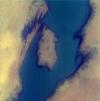
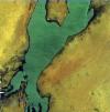
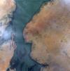
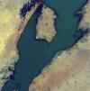
List of available products (wrsLongitudeGrid: W015, wrsLatitudeGrid: N16).
PR1_OPER_CHR_MO3_1P_20090510T110200_N16-019_W015-087_0001
Download Product | Browsefootprint | 16.26 -15.92 16.14 -15.94 16.12 -15.82 16.24 -15.80 16.26 -15.92 |
beginAcquisition | 2009-05-10T11:02:00Z |
endAcquisition | 2009-05-10T11:06:00Z |
operationalMode | MODE-3 |
orbitNumber | 0 |
wrsLongitudeGrid | W015 |
wrsLatitudeGrid | N16 |
productType | CHR_MO3_1P |
originalName | CHRIS_NI_090510_B464_41 |
siteName | Gnith |
PR1_OPER_CHR_MO3_1P_20090107T111500_N16-019_W015-087_0001
Download Product | Browsefootprint | 16.26 -15.92 16.14 -15.94 16.12 -15.82 16.24 -15.80 16.26 -15.92 |
beginAcquisition | 2009-01-07T11:15:00Z |
endAcquisition | 2009-01-07T11:19:00Z |
operationalMode | MODE-3 |
orbitNumber | 0 |
wrsLongitudeGrid | W015 |
wrsLatitudeGrid | N16 |
productType | CHR_MO3_1P |
originalName | CHRIS_NI_090107_AE42_41 |
siteName | Gnith |
PR1_OPER_CHR_MO3_1P_20081001T110700_N16-019_W015-087_0001
Download Product | Browsefootprint | 16.26 -15.92 16.14 -15.94 16.12 -15.82 16.24 -15.80 16.26 -15.92 |
beginAcquisition | 2008-10-01T11:07:00Z |
endAcquisition | 2008-10-01T11:11:00Z |
operationalMode | MODE-3 |
orbitNumber | 0 |
wrsLongitudeGrid | W015 |
wrsLatitudeGrid | N16 |
productType | CHR_MO3_1P |
originalName | CHRIS_NI_081001_A7FD_41 |
siteName | Gnith |
PR1_OPER_CHR_MO3_1P_20080905T111300_N16-019_W015-087_0001
Download Product | Browsefootprint | 16.26 -15.92 16.14 -15.94 16.12 -15.82 16.24 -15.80 16.26 -15.92 |
beginAcquisition | 2008-09-05T11:13:00Z |
endAcquisition | 2008-09-05T11:17:00Z |
operationalMode | MODE-3 |
orbitNumber | 0 |
wrsLongitudeGrid | W015 |
wrsLatitudeGrid | N16 |
productType | CHR_MO3_1P |
originalName | CHRIS_NI_080905_A5E1_41 |
siteName | Gnith |
PR1_OPER_CHR_MO2_1P_20080427T112700_N16-016_W015-088_0001
Download Product | Browsefootprint | 16.24 -15.94 16.11 -15.96 16.08 -15.82 16.21 -15.80 16.24 -15.94 |
beginAcquisition | 2008-04-27T11:27:00Z |
endAcquisition | 2008-04-27T11:31:00Z |
operationalMode | MODE-2 |
orbitNumber | 0 |
wrsLongitudeGrid | W015 |
wrsLatitudeGrid | N16 |
productType | CHR_MO2_1P |
originalName | CHRIS_GU_080427_9B78_41 |
siteName | Guiers |
PR1_OPER_CHR_MO2_1P_20080401T113100_N16-016_W015-088_0001
Download Product | Browsefootprint | 16.24 -15.94 16.10 -15.96 16.08 -15.82 16.22 -15.80 16.24 -15.94 |
beginAcquisition | 2008-04-01T11:31:00Z |
endAcquisition | 2008-04-01T11:35:00Z |
operationalMode | MODE-2 |
orbitNumber | 0 |
wrsLongitudeGrid | W015 |
wrsLatitudeGrid | N16 |
productType | CHR_MO2_1P |
originalName | CHRIS_GU_080401_995C_41 |
siteName | Guiers |
PR1_OPER_CHR_MO2_1P_20080323T112900_N16-016_W015-088_0001
Download Product | Browsefootprint | 16.23 -15.93 16.11 -15.95 16.09 -15.83 16.21 -15.81 16.23 -15.93 |
beginAcquisition | 2008-03-23T11:29:00Z |
endAcquisition | 2008-03-23T11:33:00Z |
operationalMode | MODE-2 |
orbitNumber | 0 |
wrsLongitudeGrid | W015 |
wrsLatitudeGrid | N16 |
productType | CHR_MO2_1P |
originalName | CHRIS_GU_080323_98C6_41 |
siteName | Guiers |
PR1_OPER_CHR_MO2_1P_20080314T112700_N16-016_W015-088_0001
Download Product | Browsefootprint | 16.23 -15.93 16.11 -15.95 16.09 -15.83 16.21 -15.81 16.23 -15.93 |
beginAcquisition | 2008-03-14T11:27:00Z |
endAcquisition | 2008-03-14T11:31:00Z |
operationalMode | MODE-2 |
orbitNumber | 0 |
wrsLongitudeGrid | W015 |
wrsLatitudeGrid | N16 |
productType | CHR_MO2_1P |
originalName | CHRIS_GU_080314_9826_41 |
siteName | Guiers |
PR1_OPER_CHR_MO2_1P_20080130T112700_N16-016_W015-088_0001
Download Product | Browsefootprint | 16.23 -15.93 16.11 -15.95 16.09 -15.83 16.21 -15.81 16.23 -15.93 |
beginAcquisition | 2008-01-30T11:27:00Z |
endAcquisition | 2008-01-30T11:31:00Z |
operationalMode | MODE-2 |
orbitNumber | 0 |
wrsLongitudeGrid | W015 |
wrsLatitudeGrid | N16 |
productType | CHR_MO2_1P |
originalName | CHRIS_GU_080130_9501_41 |
siteName | Guiers |
PR1_OPER_CHR_MO2_1P_20080121T112400_N16-016_W015-088_0001
Download Product | Browsefootprint | 16.23 -15.93 16.11 -15.95 16.09 -15.83 16.21 -15.81 16.23 -15.93 |
beginAcquisition | 2008-01-21T11:24:00Z |
endAcquisition | 2008-01-21T11:28:00Z |
operationalMode | MODE-2 |
orbitNumber | 0 |
wrsLongitudeGrid | W015 |
wrsLatitudeGrid | N16 |
productType | CHR_MO2_1P |
originalName | CHRIS_GU_080121_945C_41 |
siteName | Guiers |
PR1_OPER_CHR_MO3_1P_20071209T113400_N16-019_W015-087_0001
Download Product | Browsefootprint | 16.26 -15.92 16.14 -15.94 16.12 -15.82 16.24 -15.80 16.26 -15.92 |
beginAcquisition | 2007-12-09T11:34:00Z |
endAcquisition | 2007-12-09T11:38:00Z |
operationalMode | MODE-3 |
orbitNumber | 0 |
wrsLongitudeGrid | W015 |
wrsLatitudeGrid | N16 |
productType | CHR_MO3_1P |
originalName | CHRIS_NI_071209_9173_41 |
siteName | Gnith |
PR1_OPER_CHR_MO3_1P_20071122T114000_N16-019_W015-087_0001
Download Product | Browsefootprint | 16.26 -15.93 16.14 -15.95 16.12 -15.81 16.24 -15.79 16.26 -15.93 |
beginAcquisition | 2007-11-22T11:40:00Z |
endAcquisition | 2007-11-22T11:44:00Z |
operationalMode | MODE-3 |
orbitNumber | 0 |
wrsLongitudeGrid | W015 |
wrsLatitudeGrid | N16 |
productType | CHR_MO3_1P |
originalName | CHRIS_NI_071122_9079_41 |
siteName | Gnith |
PR1_OPER_CHR_MO2_1P_20070409T114400_N16-016_W015-088_0001
Download Product | Browsefootprint | 16.22 -15.93 16.11 -15.95 16.10 -15.83 16.21 -15.81 16.22 -15.93 |
beginAcquisition | 2007-04-09T11:44:00Z |
endAcquisition | 2007-04-09T11:48:00Z |
operationalMode | MODE-2 |
orbitNumber | 0 |
wrsLongitudeGrid | W015 |
wrsLatitudeGrid | N16 |
productType | CHR_MO2_1P |
originalName | CHRIS_GU_070409_8007_41 |
siteName | Guiers |
PR1_OPER_CHR_MO2_1P_20070225T115000_N16-016_W015-088_0001
Download Product | Browsefootprint | 16.24 -15.94 16.10 -15.96 16.08 -15.82 16.22 -15.80 16.24 -15.94 |
beginAcquisition | 2007-02-25T11:50:00Z |
endAcquisition | 2007-02-25T11:54:00Z |
operationalMode | MODE-2 |
orbitNumber | 0 |
wrsLongitudeGrid | W015 |
wrsLatitudeGrid | N16 |
productType | CHR_MO2_1P |
originalName | CHRIS_GU_070225_7CDD_41 |
siteName | Guiers |
PR1_OPER_CHR_MO2_1P_20060420T115600_N16-016_W015-088_0001
Download Product | Browsefootprint | 16.23 -15.93 16.11 -15.95 16.09 -15.83 16.21 -15.81 16.23 -15.93 |
beginAcquisition | 2006-04-20T11:56:00Z |
endAcquisition | 2006-04-20T12:00:00Z |
operationalMode | MODE-2 |
orbitNumber | 0 |
wrsLongitudeGrid | W015 |
wrsLatitudeGrid | N16 |
productType | CHR_MO2_1P |
originalName | CHRIS_GU_060420_6A36_41 |
siteName | Guiers |
PR1_OPER_CHR_MO2_1P_20060116T120000_N16-016_W015-088_0001
Download Product | Browsefootprint | 16.23 -15.93 16.11 -15.95 16.09 -15.83 16.21 -15.81 16.23 -15.93 |
beginAcquisition | 2006-01-16T12:00:00Z |
endAcquisition | 2006-01-16T12:04:00Z |
operationalMode | MODE-2 |
orbitNumber | 0 |
wrsLongitudeGrid | W015 |
wrsLatitudeGrid | N16 |
productType | CHR_MO2_1P |
originalName | CHRIS_GU_060116_62BC_41 |
siteName | Guiers |
PR1_OPER_CHR_MO2_1P_20051203T114600_N16-016_W015-088_0001
Download Product | Browsefootprint | 16.25 -15.95 16.10 -15.97 16.07 -15.81 16.22 -15.79 16.25 -15.95 |
beginAcquisition | 2005-12-03T11:46:00Z |
endAcquisition | 2005-12-03T11:50:00Z |
operationalMode | MODE-2 |
orbitNumber | 0 |
wrsLongitudeGrid | W015 |
wrsLatitudeGrid | N16 |
productType | CHR_MO2_1P |
originalName | CHRIS_GU_051203_601D_41 |
siteName | Guiers |
