ESA TPM Map Catalogue - Product List
back to previous node |
list of download URLs


Collection PROBA1-CHRIS
PROBA-1 CHRIS. More details here.
List of available products (wrsLongitudeGrid: W055, wrsLatitudeGrid: S02).
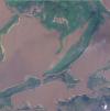
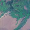
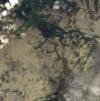
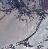
PR1_OPER_CHR_MO1_1P_20081110T133900_S02-001_W055-006_0001
Download Product | Browse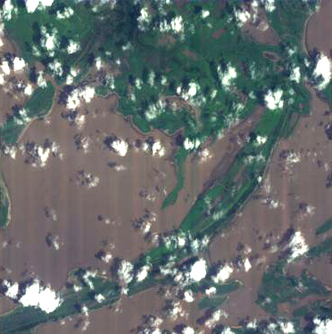
footprint | -02.06 -55.66 -02.16 -55.64 -02.14 -55.54 -02.08 -55.53 -02.06 -55.66 |
beginAcquisition | 2008-11-10T13:39:00Z |
endAcquisition | 2008-11-10T13:43:00Z |
operationalMode | MODE-1 |
orbitNumber | 0 |
wrsLongitudeGrid | W055 |
wrsLatitudeGrid | S02 |
productType | CHR_MO1_1P |
originalName | CHRIS_AM_081110_AA91_41 |
siteName | Amazon-River |
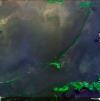
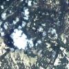
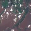
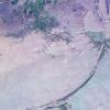
PR1_OPER_CHR_MO1_1P_20081101T133800_S02-001_W055-006_0001
Download Product | Browse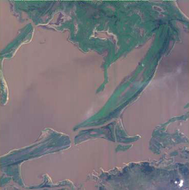
footprint | -02.06 -55.66 -02.16 -55.64 -02.14 -55.54 -02.08 -55.53 -02.06 -55.66 |
beginAcquisition | 2008-11-01T13:38:00Z |
endAcquisition | 2008-11-01T13:42:00Z |
operationalMode | MODE-1 |
orbitNumber | 0 |
wrsLongitudeGrid | W055 |
wrsLatitudeGrid | S02 |
productType | CHR_MO1_1P |
originalName | CHRIS_AM_081101_A9F6_41 |
siteName | Amazon-River |
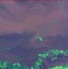
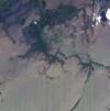
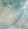
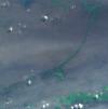
PR1_OPER_CHR_MO1_1P_20080805T134100_S02-001_W055-006_0001
Download Product | Browse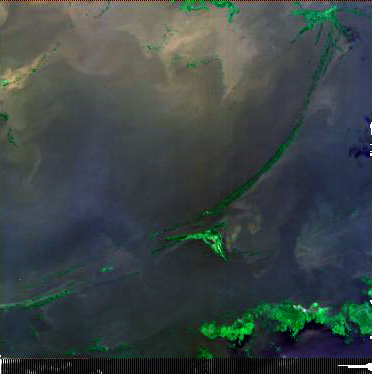
footprint | -02.06 -55.66 -02.16 -55.64 -02.14 -55.54 -02.08 -55.53 -02.06 -55.66 |
beginAcquisition | 2008-08-05T13:41:00Z |
endAcquisition | 2008-08-05T13:45:00Z |
operationalMode | MODE-1 |
orbitNumber | 0 |
wrsLongitudeGrid | W055 |
wrsLatitudeGrid | S02 |
productType | CHR_MO1_1P |
originalName | CHRIS_AM_080805_A348_41 |
siteName | Amazon-River |
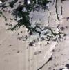
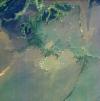
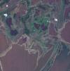
PR1_OPER_CHR_MO1_1P_20080622T134200_S02-001_W055-006_0001
Download Product | Browse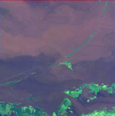
footprint | -02.06 -55.66 -02.16 -55.64 -02.14 -55.54 -02.08 -55.53 -02.06 -55.66 |
beginAcquisition | 2008-06-22T13:42:00Z |
endAcquisition | 2008-06-22T13:46:00Z |
operationalMode | MODE-1 |
orbitNumber | 0 |
wrsLongitudeGrid | W055 |
wrsLatitudeGrid | S02 |
productType | CHR_MO1_1P |
originalName | CHRIS_AM_080622_A028_41 |
siteName | Amazon-River |
PR1_OPER_CHR_MO1_1P_20080310T140100_S02-001_W055-006_0001
Download Product | Browse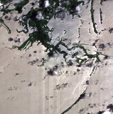
footprint | -02.06 -55.66 -02.16 -55.64 -02.14 -55.54 -02.08 -55.53 -02.06 -55.66 |
beginAcquisition | 2008-03-10T14:01:00Z |
endAcquisition | 2008-03-10T14:05:00Z |
operationalMode | MODE-1 |
orbitNumber | 0 |
wrsLongitudeGrid | W055 |
wrsLatitudeGrid | S02 |
productType | CHR_MO1_1P |
originalName | CHRIS_AM_080310_97E5_41 |
siteName | Amazon-River |
PR1_OPER_CHR_MO1_1P_20071126T140500_S02-001_W055-006_0001
Download Product | Browse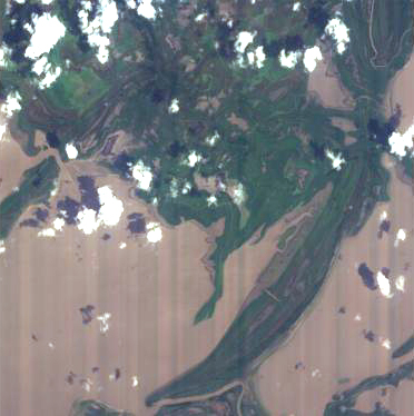
footprint | -02.06 -55.66 -02.16 -55.64 -02.14 -55.54 -02.08 -55.53 -02.06 -55.66 |
beginAcquisition | 2007-11-26T14:05:00Z |
endAcquisition | 2007-11-26T14:09:00Z |
operationalMode | MODE-1 |
orbitNumber | 0 |
wrsLongitudeGrid | W055 |
wrsLatitudeGrid | S02 |
productType | CHR_MO1_1P |
originalName | CHRIS_AM_071126_90B5_41 |
siteName | Amazon-River |
PR1_OPER_CHR_MO1_1P_20071108T140000_S02-001_W055-006_0001
Download Product | Browse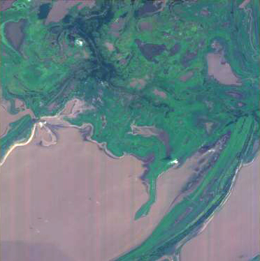
footprint | -02.06 -55.65 -02.15 -55.64 -02.14 -55.55 -02.08 -55.54 -02.06 -55.65 |
beginAcquisition | 2007-11-08T14:00:00Z |
endAcquisition | 2007-11-08T14:04:00Z |
operationalMode | MODE-1 |
orbitNumber | 0 |
wrsLongitudeGrid | W055 |
wrsLatitudeGrid | S02 |
productType | CHR_MO1_1P |
originalName | CHRIS_AM_071108_8FAC_41 |
siteName | Amazon-River |
PR1_OPER_CHR_MO1_1P_20070926T141000_S02-001_W055-006_0001
Download Product | Browse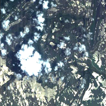
footprint | -02.06 -55.66 -02.16 -55.64 -02.14 -55.54 -02.08 -55.53 -02.06 -55.66 |
beginAcquisition | 2007-09-26T14:10:00Z |
endAcquisition | 2007-09-26T14:14:00Z |
operationalMode | MODE-1 |
orbitNumber | 0 |
wrsLongitudeGrid | W055 |
wrsLatitudeGrid | S02 |
productType | CHR_MO1_1P |
originalName | CHRIS_AM_070926_8C19_41 |
siteName | Amazon-River |
PR1_OPER_CHR_MO1_1P_20070831T141200_S02-001_W055-006_0001
Download Product | Browse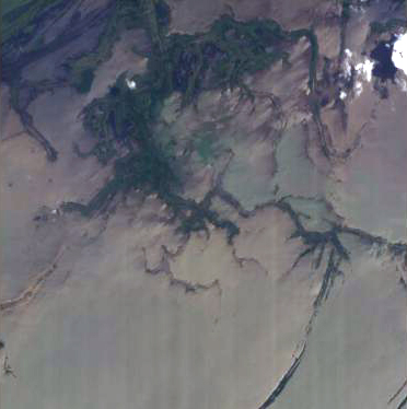
footprint | -02.05 -55.67 -02.17 -55.65 -02.15 -55.53 -02.08 -55.52 -02.05 -55.67 |
beginAcquisition | 2007-08-31T14:12:00Z |
endAcquisition | 2007-08-31T14:16:00Z |
operationalMode | MODE-1 |
orbitNumber | 0 |
wrsLongitudeGrid | W055 |
wrsLatitudeGrid | S02 |
productType | CHR_MO1_1P |
originalName | CHRIS_AM_070831_8A39_41 |
siteName | Amazon-River |
PR1_OPER_CHR_MO1_1P_20070830T140100_S02-001_W055-006_0001
Download Product | Browse
footprint | -02.06 -55.66 -02.16 -55.64 -02.14 -55.54 -02.08 -55.53 -02.06 -55.66 |
beginAcquisition | 2007-08-30T14:01:00Z |
endAcquisition | 2007-08-30T14:05:00Z |
operationalMode | MODE-1 |
orbitNumber | 0 |
wrsLongitudeGrid | W055 |
wrsLatitudeGrid | S02 |
productType | CHR_MO1_1P |
originalName | CHRIS_AM_070830_8A20_41 |
siteName | Amazon-River |
PR1_OPER_CHR_MO1_1P_20070701T141500_S02-001_W055-006_0001
Download Product | Browse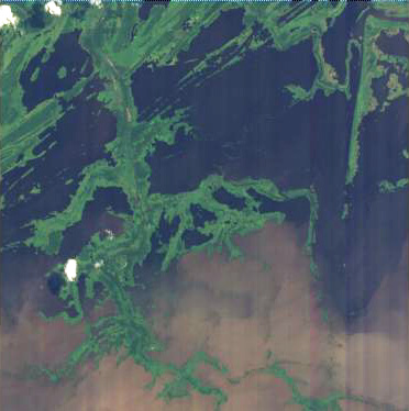
footprint | -02.06 -55.66 -02.16 -55.64 -02.14 -55.54 -02.08 -55.53 -02.06 -55.66 |
beginAcquisition | 2007-07-01T14:15:00Z |
endAcquisition | 2007-07-01T14:19:00Z |
operationalMode | MODE-1 |
orbitNumber | 0 |
wrsLongitudeGrid | W055 |
wrsLatitudeGrid | S02 |
productType | CHR_MO1_1P |
originalName | CHRIS_AM_070701_8615_41 |
siteName | Amazon-River |
PR1_OPER_CHR_MO1_1P_20070327T141500_S02-001_W055-006_0001
Download Product | Browse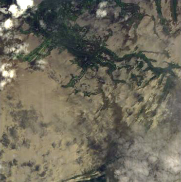
footprint | -02.06 -55.65 -02.15 -55.64 -02.14 -55.55 -02.08 -55.54 -02.06 -55.65 |
beginAcquisition | 2007-03-27T14:15:00Z |
endAcquisition | 2007-03-27T14:19:00Z |
operationalMode | MODE-1 |
orbitNumber | 0 |
wrsLongitudeGrid | W055 |
wrsLatitudeGrid | S02 |
productType | CHR_MO1_1P |
originalName | CHRIS_AM_070327_7F2B_41 |
siteName | Amazon-River |
PR1_OPER_CHR_MO1_1P_20070228T140500_S02-001_W055-006_0001
Download Product | Browse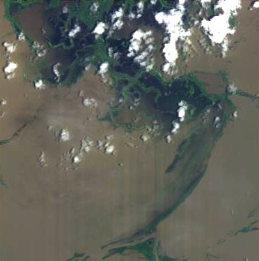
footprint | -02.06 -55.66 -02.16 -55.64 -02.14 -55.54 -02.08 -55.53 -02.06 -55.66 |
beginAcquisition | 2007-02-28T14:05:00Z |
endAcquisition | 2007-02-28T14:09:00Z |
operationalMode | MODE-1 |
orbitNumber | 0 |
wrsLongitudeGrid | W055 |
wrsLatitudeGrid | S02 |
productType | CHR_MO1_1P |
originalName | CHRIS_AM_070228_7D19_41 |
siteName | Amazon-River |
PR1_OPER_CHR_MO1_1P_20061030T141200_S02-001_W055-006_0001
Download Product | Browse
footprint | -02.06 -55.66 -02.16 -55.64 -02.14 -55.54 -02.08 -55.53 -02.06 -55.66 |
beginAcquisition | 2006-10-30T14:12:00Z |
endAcquisition | 2006-10-30T14:16:00Z |
operationalMode | MODE-1 |
orbitNumber | 0 |
wrsLongitudeGrid | W055 |
wrsLatitudeGrid | S02 |
productType | CHR_MO1_1P |
originalName | CHRIS_AM_061030_7701_41 |
siteName | Amazon-River |
PR1_OPER_CHR_MO1_1P_20061013T141500_S02-001_W055-006_0001
Download Product | Browse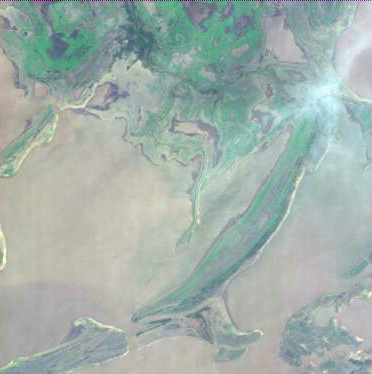
footprint | -02.06 -55.66 -02.16 -55.64 -02.14 -55.54 -02.08 -55.53 -02.06 -55.66 |
beginAcquisition | 2006-10-13T14:15:00Z |
endAcquisition | 2006-10-13T14:19:00Z |
operationalMode | MODE-1 |
orbitNumber | 0 |
wrsLongitudeGrid | W055 |
wrsLatitudeGrid | S02 |
productType | CHR_MO1_1P |
originalName | CHRIS_AM_061013_75D0_41 |
siteName | Amazon-River |
PR1_OPER_CHR_MO1_1P_20061003T141100_S02-001_W055-006_0001
Download Product | Browse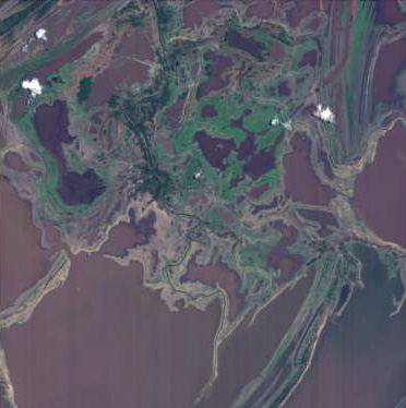
footprint | -02.05 -55.66 -02.16 -55.65 -02.15 -55.54 -02.08 -55.53 -02.05 -55.66 |
beginAcquisition | 2006-10-03T14:11:00Z |
endAcquisition | 2006-10-03T14:15:00Z |
operationalMode | MODE-1 |
orbitNumber | 0 |
wrsLongitudeGrid | W055 |
wrsLatitudeGrid | S02 |
productType | CHR_MO1_1P |
originalName | CHRIS_AM_061003_753A_41 |
siteName | Amazon-River |
PR1_OPER_CHR_MO1_1P_20060909T142200_S02-001_W055-006_0001
Download Product | Browse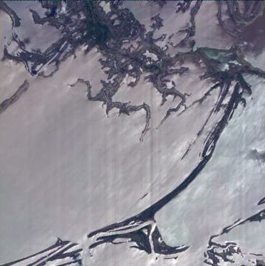
footprint | -02.06 -55.65 -02.15 -55.64 -02.14 -55.55 -02.08 -55.54 -02.06 -55.65 |
beginAcquisition | 2006-09-09T14:22:00Z |
endAcquisition | 2006-09-09T14:26:00Z |
operationalMode | MODE-1 |
orbitNumber | 0 |
wrsLongitudeGrid | W055 |
wrsLatitudeGrid | S02 |
productType | CHR_MO1_1P |
originalName | CHRIS_AM_060909_73C3_41 |
siteName | Amazon-River |
PR1_OPER_CHR_MO1_1P_20060831T141800_S02-001_W055-006_0001
Download Product | Browse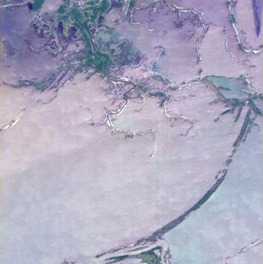
footprint | -02.06 -55.66 -02.16 -55.64 -02.14 -55.54 -02.08 -55.53 -02.06 -55.66 |
beginAcquisition | 2006-08-31T14:18:00Z |
endAcquisition | 2006-08-31T14:22:00Z |
operationalMode | MODE-1 |
orbitNumber | 0 |
wrsLongitudeGrid | W055 |
wrsLatitudeGrid | S02 |
productType | CHR_MO1_1P |
originalName | CHRIS_AM_060831_7337_41 |
siteName | Amazon-River |
PR1_OPER_CHR_MO1_1P_20060702T142300_S02-001_W055-006_0001
Download Product | Browse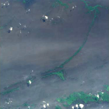
footprint | -02.06 -55.66 -02.16 -55.64 -02.14 -55.54 -02.08 -55.53 -02.06 -55.66 |
beginAcquisition | 2006-07-02T14:23:00Z |
endAcquisition | 2006-07-02T14:27:00Z |
operationalMode | MODE-1 |
orbitNumber | 0 |
wrsLongitudeGrid | W055 |
wrsLatitudeGrid | S02 |
productType | CHR_MO1_1P |
originalName | CHRIS_AM_060702_6F3B_41 |
siteName | Amazon-River |