ESA TPM Map Catalogue - Product List
back to previous node |
list of download URLs
Collection PROBA1-CHRIS
PROBA-1 CHRIS. More details here.
List of available products (wrsLongitudeGrid: W081, wrsLatitudeGrid: N46).
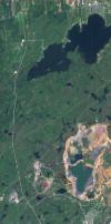
PR1_OPER_CHR_MO5_1P_20130829T122300_N46-047_W081-012_0001
Download Product | Browsefootprint | 46.55 -81.20 46.41 -81.24 46.40 -81.02 46.54 -81.02 46.55 -81.20 |
beginAcquisition | 2013-08-29T12:23:00Z |
endAcquisition | 2013-08-29T12:27:00Z |
operationalMode | MODE-5 |
orbitNumber | 0 |
wrsLongitudeGrid | W081 |
wrsLatitudeGrid | N46 |
productType | CHR_MO5_1P |
originalName | CHRIS_SU_130829_F8BB_41 |
siteName | Sudbury |
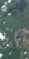
PR1_OPER_CHR_MO5_1P_20110615T141500_N46-047_W081-012_0001
Download Product | Browsefootprint | 46.53 -81.19 46.42 -81.21 46.42 -81.04 46.52 -81.04 46.53 -81.19 |
beginAcquisition | 2011-06-15T14:15:00Z |
endAcquisition | 2011-06-15T14:19:00Z |
operationalMode | MODE-5 |
orbitNumber | 0 |
wrsLongitudeGrid | W081 |
wrsLatitudeGrid | N46 |
productType | CHR_MO5_1P |
originalName | CHRIS_SU_110615_DBA6_41 |
siteName | Sudbury |
PR1_OPER_CHR_MO5_1P_20091217T152700_N46-047_W081-012_0001
Download Product | Browsefootprint | 46.54 -81.19 46.42 -81.22 46.41 -81.04 46.53 -81.04 46.54 -81.19 |
beginAcquisition | 2009-12-17T15:27:00Z |
endAcquisition | 2009-12-17T15:31:00Z |
operationalMode | MODE-5 |
orbitNumber | 0 |
wrsLongitudeGrid | W081 |
wrsLatitudeGrid | N46 |
productType | CHR_MO5_1P |
originalName | CHRIS_SU_091217_C17A_41 |
siteName | Sudbury |
PR1_OPER_CHR_MO5_1P_20091208T152700_N46-047_W081-012_0001
Download Product | Browsefootprint | 46.53 -81.19 46.42 -81.21 46.41 -81.04 46.53 -81.04 46.53 -81.19 |
beginAcquisition | 2009-12-08T15:27:00Z |
endAcquisition | 2009-12-08T15:31:00Z |
operationalMode | MODE-5 |
orbitNumber | 0 |
wrsLongitudeGrid | W081 |
wrsLatitudeGrid | N46 |
productType | CHR_MO5_1P |
originalName | CHRIS_SU_091208_C0FD_41 |
siteName | Sudbury |
PR1_OPER_CHR_MO5_1P_20091016T153200_N46-047_W081-012_0001
Download Product | Browsefootprint | 46.55 -81.20 46.41 -81.23 46.40 -81.02 46.54 -81.02 46.55 -81.20 |
beginAcquisition | 2009-10-16T15:32:00Z |
endAcquisition | 2009-10-16T15:36:00Z |
operationalMode | MODE-5 |
orbitNumber | 0 |
wrsLongitudeGrid | W081 |
wrsLatitudeGrid | N46 |
productType | CHR_MO5_1P |
originalName | CHRIS_SU_091016_BDC4_41 |
siteName | Sudbury |
PR1_OPER_CHR_MO5_1P_20090920T153900_N46-047_W081-012_0001
Download Product | Browsefootprint | 46.55 -81.20 46.41 -81.23 46.40 -81.02 46.54 -81.02 46.55 -81.20 |
beginAcquisition | 2009-09-20T15:39:00Z |
endAcquisition | 2009-09-20T15:43:00Z |
operationalMode | MODE-5 |
orbitNumber | 0 |
wrsLongitudeGrid | W081 |
wrsLatitudeGrid | N46 |
productType | CHR_MO5_1P |
originalName | CHRIS_SU_090920_BC11_41 |
siteName | Sudbury |
PR1_OPER_CHR_MO5_1P_20090902T153700_N46-047_W081-012_0001
Download Product | Browsefootprint | 46.54 -81.19 46.42 -81.22 46.41 -81.04 46.53 -81.04 46.54 -81.19 |
beginAcquisition | 2009-09-02T15:37:00Z |
endAcquisition | 2009-09-02T15:41:00Z |
operationalMode | MODE-5 |
orbitNumber | 0 |
wrsLongitudeGrid | W081 |
wrsLatitudeGrid | N46 |
productType | CHR_MO5_1P |
originalName | CHRIS_SU_090902_BB0D_41 |
siteName | Sudbury |
PR1_OPER_CHR_MO5_1P_20090606T154700_N46-047_W081-012_0001
Download Product | Browsefootprint | 46.55 -81.20 46.42 -81.23 46.41 -81.03 46.54 -81.03 46.55 -81.20 |
beginAcquisition | 2009-06-06T15:47:00Z |
endAcquisition | 2009-06-06T15:51:00Z |
operationalMode | MODE-5 |
orbitNumber | 0 |
wrsLongitudeGrid | W081 |
wrsLatitudeGrid | N46 |
productType | CHR_MO5_1P |
originalName | CHRIS_SU_090606_B5D6_41 |
siteName | Sudbury |
PR1_OPER_CHR_MO5_1P_20090220T155300_N46-047_W081-012_0001
Download Product | Browsefootprint | 46.54 -81.20 46.42 -81.22 46.41 -81.03 46.53 -81.03 46.54 -81.20 |
beginAcquisition | 2009-02-20T15:53:00Z |
endAcquisition | 2009-02-20T15:57:00Z |
operationalMode | MODE-5 |
orbitNumber | 0 |
wrsLongitudeGrid | W081 |
wrsLatitudeGrid | N46 |
productType | CHR_MO5_1P |
originalName | CHRIS_SU_090220_B059_41 |
siteName | Sudbury |
PR1_OPER_CHR_MO5_1P_20090125T155900_N46-047_W081-012_0001
Download Product | Browsefootprint | 46.54 -81.19 46.42 -81.22 46.41 -81.04 46.53 -81.04 46.54 -81.19 |
beginAcquisition | 2009-01-25T15:59:00Z |
endAcquisition | 2009-01-25T16:03:00Z |
operationalMode | MODE-5 |
orbitNumber | 0 |
wrsLongitudeGrid | W081 |
wrsLatitudeGrid | N46 |
productType | CHR_MO5_1P |
originalName | CHRIS_SU_090125_AF19_41 |
siteName | Sudbury |
PR1_OPER_CHR_MO5_1P_20080828T160400_N46-047_W081-012_0001
Download Product | Browsefootprint | 46.54 -81.20 46.42 -81.23 46.41 -81.03 46.53 -81.03 46.54 -81.20 |
beginAcquisition | 2008-08-28T16:04:00Z |
endAcquisition | 2008-08-28T16:08:00Z |
operationalMode | MODE-5 |
orbitNumber | 0 |
wrsLongitudeGrid | W081 |
wrsLatitudeGrid | N46 |
productType | CHR_MO5_1P |
originalName | CHRIS_SU_080828_A555_41 |
siteName | Sudbury |
PR1_OPER_CHR_MO5_1P_20080819T160200_N46-047_W081-012_0001
Download Product | Browsefootprint | 46.54 -81.20 46.42 -81.23 46.41 -81.03 46.53 -81.03 46.54 -81.20 |
beginAcquisition | 2008-08-19T16:02:00Z |
endAcquisition | 2008-08-19T16:06:00Z |
operationalMode | MODE-5 |
orbitNumber | 0 |
wrsLongitudeGrid | W081 |
wrsLatitudeGrid | N46 |
productType | CHR_MO5_1P |
originalName | CHRIS_SU_080819_A492_41 |
siteName | Sudbury |
PR1_OPER_CHR_MO5_1P_20080419T161700_N46-047_W081-012_0001
Download Product | Browsefootprint | 46.55 -81.21 46.41 -81.24 46.40 -81.02 46.54 -81.02 46.55 -81.21 |
beginAcquisition | 2008-04-19T16:17:00Z |
endAcquisition | 2008-04-19T16:21:00Z |
operationalMode | MODE-5 |
orbitNumber | 0 |
wrsLongitudeGrid | W081 |
wrsLatitudeGrid | N46 |
productType | CHR_MO5_1P |
originalName | CHRIS_SU_080419_9AD8_41 |
siteName | Sudbury |
PR1_OPER_CHR_MO5_1P_20080323T161100_N46-047_W081-012_0001
Download Product | Browsefootprint | 46.54 -81.19 46.42 -81.22 46.41 -81.04 46.53 -81.04 46.54 -81.19 |
beginAcquisition | 2008-03-23T16:11:00Z |
endAcquisition | 2008-03-23T16:15:00Z |
operationalMode | MODE-5 |
orbitNumber | 0 |
wrsLongitudeGrid | W081 |
wrsLatitudeGrid | N46 |
productType | CHR_MO5_1P |
originalName | CHRIS_SU_080323_98CB_41 |
siteName | Sudbury |
PR1_OPER_CHR_MO5_1P_20070903T160900_N46-047_W081-012_0001
Download Product | Browsefootprint | 46.55 -81.21 46.41 -81.24 46.40 -81.02 46.54 -81.02 46.55 -81.21 |
beginAcquisition | 2007-09-03T16:09:00Z |
endAcquisition | 2007-09-03T16:13:00Z |
operationalMode | MODE-5 |
orbitNumber | 0 |
wrsLongitudeGrid | W081 |
wrsLatitudeGrid | N46 |
productType | CHR_MO5_1P |
originalName | CHRIS_SU_070903_8A61_41 |
siteName | Sudbury |
PR1_OPER_CHR_MO5_1P_20070617T161700_N46-047_W081-012_0001
Download Product | Browsefootprint | 46.55 -81.20 46.41 -81.23 46.40 -81.02 46.54 -81.02 46.55 -81.20 |
beginAcquisition | 2007-06-17T16:17:00Z |
endAcquisition | 2007-06-17T16:21:00Z |
operationalMode | MODE-5 |
orbitNumber | 0 |
wrsLongitudeGrid | W081 |
wrsLatitudeGrid | N46 |
productType | CHR_MO5_1P |
originalName | CHRIS_SU_070617_850C_41 |
siteName | Sudbury |
PR1_OPER_CHR_MO5_1P_20070306T163500_N46-047_W081-012_0001
Download Product | Browsefootprint | 46.55 -81.20 46.42 -81.23 46.40 -81.02 46.54 -81.02 46.55 -81.20 |
beginAcquisition | 2007-03-06T16:35:00Z |
endAcquisition | 2007-03-06T16:39:00Z |
operationalMode | MODE-5 |
orbitNumber | 0 |
wrsLongitudeGrid | W081 |
wrsLatitudeGrid | N46 |
productType | CHR_MO5_1P |
originalName | CHRIS_SU_070306_7D8C_41 |
siteName | Sudbury |
PR1_OPER_CHR_MO1_1P_20070216T162800_N46-085_W081-039_0001
Download Product | Browsefootprint | 46.89 -81.48 46.79 -81.45 46.81 -81.30 46.87 -81.29 46.89 -81.48 |
beginAcquisition | 2007-02-16T16:28:00Z |
endAcquisition | 2007-02-16T16:32:00Z |
operationalMode | MODE-1 |
orbitNumber | 0 |
wrsLongitudeGrid | W081 |
wrsLatitudeGrid | N46 |
productType | CHR_MO1_1P |
originalName | CHRIS_AG_070216_7C51_41 |
siteName | Algoma |
PR1_OPER_CHR_MO5_1P_20070130T163300_N46-047_W081-012_0001
Download Product | Browsefootprint | 46.54 -81.20 46.42 -81.23 46.41 -81.03 46.53 -81.03 46.54 -81.20 |
beginAcquisition | 2007-01-30T16:33:00Z |
endAcquisition | 2007-01-30T16:37:00Z |
operationalMode | MODE-5 |
orbitNumber | 0 |
wrsLongitudeGrid | W081 |
wrsLatitudeGrid | N46 |
productType | CHR_MO5_1P |
originalName | CHRIS_SU_070130_7B75_41 |
siteName | Sudbury |
PR1_OPER_CHR_MO1_1P_20061218T163800_N46-085_W081-039_0001
Download Product | Browsefootprint | 46.89 -81.47 46.80 -81.44 46.81 -81.31 46.87 -81.30 46.89 -81.47 |
beginAcquisition | 2006-12-18T16:38:00Z |
endAcquisition | 2006-12-18T16:42:00Z |
operationalMode | MODE-1 |
orbitNumber | 0 |
wrsLongitudeGrid | W081 |
wrsLatitudeGrid | N46 |
productType | CHR_MO1_1P |
originalName | CHRIS_AG_061218_7AB7_41 |
siteName | Algoma |
PR1_OPER_CHR_MO1_1P_20061208T162400_N46-085_W081-039_0001
Download Product | Browsefootprint | 46.89 -81.47 46.79 -81.45 46.81 -81.31 46.87 -81.29 46.89 -81.47 |
beginAcquisition | 2006-12-08T16:24:00Z |
endAcquisition | 2006-12-08T16:28:00Z |
operationalMode | MODE-1 |
orbitNumber | 0 |
wrsLongitudeGrid | W081 |
wrsLatitudeGrid | N46 |
productType | CHR_MO1_1P |
originalName | CHRIS_AG_061208_7A08_41 |
siteName | Algoma |
PR1_OPER_CHR_MO5_1P_20061112T162400_N46-047_W081-012_0001
Download Product | Browsefootprint | 46.55 -81.20 46.41 -81.23 46.40 -81.02 46.54 -81.02 46.55 -81.20 |
beginAcquisition | 2006-11-12T16:24:00Z |
endAcquisition | 2006-11-12T16:28:00Z |
operationalMode | MODE-5 |
orbitNumber | 0 |
wrsLongitudeGrid | W081 |
wrsLatitudeGrid | N46 |
productType | CHR_MO5_1P |
originalName | CHRIS_SU_061112_780F_41 |
siteName | Sudbury |
PR1_OPER_CHR_MO1_1P_20061010T164200_N46-085_W081-039_0001
Download Product | Browsefootprint | 46.89 -81.48 46.79 -81.45 46.81 -81.30 46.87 -81.29 46.89 -81.48 |
beginAcquisition | 2006-10-10T16:42:00Z |
endAcquisition | 2006-10-10T16:46:00Z |
operationalMode | MODE-1 |
orbitNumber | 0 |
wrsLongitudeGrid | W081 |
wrsLatitudeGrid | N46 |
productType | CHR_MO1_1P |
originalName | CHRIS_AG_061010_7599_41 |
siteName | Algoma |
PR1_OPER_CHR_MO1_1P_20060715T163500_N46-085_W081-039_0001
Download Product | Browsefootprint | 46.89 -81.48 46.79 -81.45 46.81 -81.30 46.87 -81.29 46.89 -81.48 |
beginAcquisition | 2006-07-15T16:35:00Z |
endAcquisition | 2006-07-15T16:39:00Z |
operationalMode | MODE-1 |
orbitNumber | 0 |
wrsLongitudeGrid | W081 |
wrsLatitudeGrid | N46 |
productType | CHR_MO1_1P |
originalName | CHRIS_AG_060715_700F_41 |
siteName | Algoma |
PR1_OPER_CHR_MO5_1P_20060620T164500_N46-047_W081-012_0001
Download Product | Browsefootprint | 46.55 -81.20 46.41 -81.23 46.40 -81.02 46.54 -81.02 46.55 -81.20 |
beginAcquisition | 2006-06-20T16:45:00Z |
endAcquisition | 2006-06-20T16:49:00Z |
operationalMode | MODE-5 |
orbitNumber | 0 |
wrsLongitudeGrid | W081 |
wrsLatitudeGrid | N46 |
productType | CHR_MO5_1P |
originalName | CHRIS_SU_060620_6E64_41 |
siteName | Sudbury |
PR1_OPER_CHR_MO1_1P_20060524T163200_N46-085_W081-039_0001
Download Product | Browsefootprint | 46.89 -81.47 46.80 -81.45 46.81 -81.31 46.87 -81.30 46.89 -81.47 |
beginAcquisition | 2006-05-24T16:32:00Z |
endAcquisition | 2006-05-24T16:36:00Z |
operationalMode | MODE-1 |
orbitNumber | 0 |
wrsLongitudeGrid | W081 |
wrsLatitudeGrid | N46 |
productType | CHR_MO1_1P |
originalName | CHRIS_AG_060524_6CAC_41 |
siteName | Algoma |
PR1_OPER_CHR_MO5_1P_20060429T164200_N46-047_W081-012_0001
Download Product | Browsefootprint | 46.54 -81.19 46.42 -81.22 46.41 -81.03 46.53 -81.03 46.54 -81.19 |
beginAcquisition | 2006-04-29T16:42:00Z |
endAcquisition | 2006-04-29T16:46:00Z |
operationalMode | MODE-5 |
orbitNumber | 0 |
wrsLongitudeGrid | W081 |
wrsLatitudeGrid | N46 |
productType | CHR_MO5_1P |
originalName | CHRIS_SU_060429_6AF9_41 |
siteName | Sudbury |
PR1_OPER_CHR_MO5_1P_20060228T164300_N46-047_W081-012_0001
Download Product | Browsefootprint | 46.54 -81.19 46.42 -81.22 46.41 -81.03 46.53 -81.03 46.54 -81.19 |
beginAcquisition | 2006-02-28T16:43:00Z |
endAcquisition | 2006-02-28T16:47:00Z |
operationalMode | MODE-5 |
orbitNumber | 0 |
wrsLongitudeGrid | W081 |
wrsLatitudeGrid | N46 |
productType | CHR_MO5_1P |
originalName | CHRIS_SU_060228_6581_41 |
siteName | Sudbury |
PR1_OPER_CHR_MO5_1P_20060219T163800_N46-047_W081-012_0001
Download Product | Browsefootprint | 46.54 -81.19 46.42 -81.22 46.41 -81.04 46.53 -81.04 46.54 -81.19 |
beginAcquisition | 2006-02-19T16:38:00Z |
endAcquisition | 2006-02-19T16:42:00Z |
operationalMode | MODE-5 |
orbitNumber | 0 |
wrsLongitudeGrid | W081 |
wrsLatitudeGrid | N46 |
productType | CHR_MO5_1P |
originalName | CHRIS_SU_060219_64D2_41 |
siteName | Sudbury |
PR1_OPER_CHR_MO5_1P_20060210T163400_N46-047_W081-012_0001
Download Product | Browsefootprint | 46.54 -81.19 46.42 -81.22 46.41 -81.04 46.53 -81.04 46.54 -81.19 |
beginAcquisition | 2006-02-10T16:34:00Z |
endAcquisition | 2006-02-10T16:38:00Z |
operationalMode | MODE-5 |
orbitNumber | 0 |
wrsLongitudeGrid | W081 |
wrsLatitudeGrid | N46 |
productType | CHR_MO5_1P |
originalName | CHRIS_SU_060210_6437_41 |
siteName | Sudbury |
PR1_OPER_CHR_MO5_1P_20060115T163100_N46-047_W081-012_0001
Download Product | Browsefootprint | 46.54 -81.20 46.42 -81.22 46.41 -81.03 46.53 -81.03 46.54 -81.20 |
beginAcquisition | 2006-01-15T16:31:00Z |
endAcquisition | 2006-01-15T16:35:00Z |
operationalMode | MODE-5 |
orbitNumber | 0 |
wrsLongitudeGrid | W081 |
wrsLatitudeGrid | N46 |
productType | CHR_MO5_1P |
originalName | CHRIS_SU_060115_62A7_41 |
siteName | Sudbury |
PR1_OPER_CHR_MO5_1P_20051230T164400_N46-047_W081-012_0001
Download Product | Browsefootprint | 46.54 -81.20 46.42 -81.22 46.41 -81.03 46.53 -81.03 46.54 -81.20 |
beginAcquisition | 2005-12-30T16:44:00Z |
endAcquisition | 2005-12-30T16:48:00Z |
operationalMode | MODE-5 |
orbitNumber | 0 |
wrsLongitudeGrid | W081 |
wrsLatitudeGrid | N46 |
productType | CHR_MO5_1P |
originalName | CHRIS_SU_051230_61A3_41 |
siteName | Sudbury |
PR1_OPER_CHR_MO5_1P_20041103T164600_N46-047_W081-012_0001
Download Product | Browsefootprint | 46.54 -81.19 46.42 -81.22 46.41 -81.04 46.53 -81.04 46.54 -81.19 |
beginAcquisition | 2004-11-03T16:46:00Z |
endAcquisition | 2004-11-03T16:50:00Z |
operationalMode | MODE-5 |
orbitNumber | 0 |
wrsLongitudeGrid | W081 |
wrsLatitudeGrid | N46 |
productType | CHR_MO5_1P |
originalName | CHRIS_SU_041103_4916_41 |
siteName | Sudbury |
PR1_OPER_CHR_MO5_1P_20040820T163700_N46-047_W081-012_0001
Download Product | Browsefootprint | 46.54 -81.19 46.42 -81.22 46.41 -81.03 46.53 -81.03 46.54 -81.19 |
beginAcquisition | 2004-08-20T16:37:00Z |
endAcquisition | 2004-08-20T16:41:00Z |
operationalMode | MODE-5 |
orbitNumber | 0 |
wrsLongitudeGrid | W081 |
wrsLatitudeGrid | N46 |
productType | CHR_MO5_1P |
originalName | CHRIS_SU_040820_44E3_41 |
siteName | Sudbury |
PR1_OPER_CHR_MO5_1P_20040719T164800_N46-047_W081-012_0001
Download Product | Browsefootprint | 46.54 -81.19 46.42 -81.22 46.41 -81.04 46.53 -81.04 46.54 -81.19 |
beginAcquisition | 2004-07-19T16:48:00Z |
endAcquisition | 2004-07-19T16:52:00Z |
operationalMode | MODE-5 |
orbitNumber | 0 |
wrsLongitudeGrid | W081 |
wrsLatitudeGrid | N46 |
productType | CHR_MO5_1P |
originalName | CHRIS_SU_040719_438A_41 |
siteName | Sudbury |
PR1_OPER_CHR_MO5_1P_20040702T164100_N46-047_W081-012_0001
Download Product | Browsefootprint | 46.54 -81.20 46.42 -81.22 46.41 -81.03 46.53 -81.03 46.54 -81.20 |
beginAcquisition | 2004-07-02T16:41:00Z |
endAcquisition | 2004-07-02T16:45:00Z |
operationalMode | MODE-5 |
orbitNumber | 0 |
wrsLongitudeGrid | W081 |
wrsLatitudeGrid | N46 |
productType | CHR_MO5_1P |
originalName | CHRIS_SU_040702_42DB_41 |
siteName | Sudbury |
PR1_OPER_CHR_MO5_1P_20040625T165500_N46-047_W081-012_0001
Download Product | Browsefootprint | 46.55 -81.21 46.41 -81.24 46.40 -81.02 46.54 -81.02 46.55 -81.21 |
beginAcquisition | 2004-06-25T16:55:00Z |
endAcquisition | 2004-06-25T16:59:00Z |
operationalMode | MODE-5 |
orbitNumber | 0 |
wrsLongitudeGrid | W081 |
wrsLatitudeGrid | N46 |
productType | CHR_MO5_1P |
originalName | CHRIS_SU_040625_429A_41 |
siteName | Sudbury |
PR1_OPER_CHR_MO5_1P_20040429T165700_N46-047_W081-012_0001
Download Product | Browsefootprint | 46.55 -81.20 46.41 -81.23 46.40 -81.02 46.54 -81.02 46.55 -81.20 |
beginAcquisition | 2004-04-29T16:57:00Z |
endAcquisition | 2004-04-29T17:01:00Z |
operationalMode | MODE-5 |
orbitNumber | 0 |
wrsLongitudeGrid | W081 |
wrsLatitudeGrid | N46 |
productType | CHR_MO5_1P |
originalName | CHRIS_SU_040429_4051_41 |
siteName | Sudbury |
PR1_OPER_CHR_MO5_1P_20040215T164500_N46-047_W081-012_0001
Download Product | Browsefootprint | 46.55 -81.20 46.42 -81.23 46.40 -81.03 46.54 -81.03 46.55 -81.20 |
beginAcquisition | 2004-02-15T16:45:00Z |
endAcquisition | 2004-02-15T16:49:00Z |
operationalMode | MODE-5 |
orbitNumber | 0 |
wrsLongitudeGrid | W081 |
wrsLatitudeGrid | N46 |
productType | CHR_MO5_1P |
originalName | CHRIS_SU_040215_3DAE_41 |
siteName | Sudbury |
PR1_OPER_CHR_MO1_1P_20031213T165000_N46-085_W081-039_0001
Download Product | Browsefootprint | 46.89 -81.47 46.80 -81.45 46.81 -81.31 46.87 -81.30 46.89 -81.47 |
beginAcquisition | 2003-12-13T16:50:00Z |
endAcquisition | 2003-12-13T16:54:00Z |
operationalMode | MODE-1 |
orbitNumber | 0 |
wrsLongitudeGrid | W081 |
wrsLatitudeGrid | N46 |
productType | CHR_MO1_1P |
originalName | CHRIS_AG_031213_3B56_41 |
siteName | Algoma |
PR1_OPER_CHR_MO5_1P_20030708T164300_N46-047_W081-012_0001
Download Product | Browsefootprint | 46.55 -81.20 46.42 -81.23 46.40 -81.03 46.54 -81.03 46.55 -81.20 |
beginAcquisition | 2003-07-08T16:43:00Z |
endAcquisition | 2003-07-08T16:47:00Z |
operationalMode | MODE-5 |
orbitNumber | 0 |
wrsLongitudeGrid | W081 |
wrsLatitudeGrid | N46 |
productType | CHR_MO5_1P |
originalName | CHRIS_SU_030708_3575_41 |
siteName | Sudbury |
PR1_OPER_CHR_MO1_1P_20030507T164200_N46-085_W081-039_0001
Download Product | Browsefootprint | 46.89 -81.47 46.80 -81.44 46.81 -81.31 46.87 -81.30 46.89 -81.47 |
beginAcquisition | 2003-05-07T16:42:00Z |
endAcquisition | 2003-05-07T16:46:00Z |
operationalMode | MODE-1 |
orbitNumber | 0 |
wrsLongitudeGrid | W081 |
wrsLatitudeGrid | N46 |
productType | CHR_MO1_1P |
originalName | CHRIS_AG_030507_340D_41 |
siteName | Algoma |
